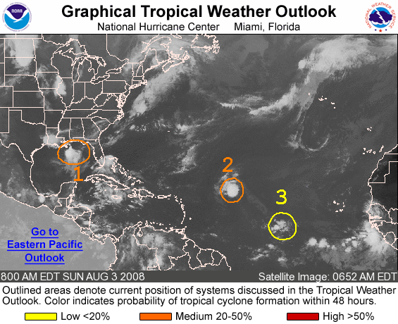
The National Hurricane Center issued a special forecast on August 30 regarding the formation of four new weather systems that have the potential to develop into major storms, with one having a high probability of making landfall in Central America. These developments are part of a record-breaking hurricane season in the Atlantic that has yet to reach its mid-September peak.
Of the four tropical systems that are the focus of the NHC’s special forecast, tropical depression fifteen is currently located off of the U.S. east coast and is expected to head out to sea as it tracks northeast; tropical disturbance sixteen is currently centered south of Jamaica and heading west toward Belize’s east coast, and is forecast to have an 80 percent chance of organizing itself into a named storm.
Another low pressure system is developing off the coast of northern Florida, and has a 70 percent chance of developing into a storm over the course of the week, although like depression fifteen it is expected to track northeast out into the Atlantic.
The remaining disturbance is currently stewing off of the west coast of Africa in the Atlantic’s Main Development Region (MDR), albeit with a less certain forecast, as the system is currently unorganized but still has the potential to form into a cohesive storm that could track across the Atlantic. The NHC forecasts that the “gradual development of this system… through the end of the week” is possible, with the forecast to become more certain once the system moves out over water.
The Atlantic basin had already produced a typical season’s worth of storms by late August, churning out 55 percent more energy in tropical storms and hurricanes than normal. 2020’s hyperactive hurricane season has already delivered the earliest named storms on record for the letters C through M, well ahead of 2005’s earlier record; this season has so far produced 13 named storms that included 5 hurricanes, with Hurricane Laura reaching Category 4-level strength by August 26, with seven of these named tropical cyclones making landfall in the U.S. before the end of August (another record)—and the 2020 Atlantic hurricane season hasn’t even reached its mid-September peak yet.
Thankfully, activity in the Atlantic is expected to calm down for the next few weeks, with an overturning circulation in the upper atmosphere called the Kelvin wave coming off of its hurricane-friendly peak. Increased thunderstorm activity may be on the menu however, as a weather pattern that circles the globe every 40 to 60 days called the Madden-Julian Oscillation is due to enter the Atlantic, possibly offsetting the calming effects of the decreasing Kelvin wave.
Although this reprieve is forecast to be likely, it isn’t expected to last for long. “There appears to be no serious tropical threat to the North America mainland during the first week of September, but the lull is not likely to last long with a bumper crop of storms expected through the end of the season that concludes at the end of November,” AccuWeather senior meteorologist Alex Sosnowski wrote on August 28.
Subscribers, to watch the subscriber version of the video, first log in then click on Dreamland Subscriber-Only Video Podcast link.
Something’s wrong with the satellite image shown with this article, It is date-stamped as “Sunday, August 3, 2008,” rather an odd sidelight to an article in 2020!
Yes, Aug. 3 was indeed on a Sun. in 2008 — but that was over twelve years ago. Perhaps the original NOAA article made the error.