A mysterious squadron of unidentified drones has been conducting nighttime operations in the skies over northeastern Colorado for a number of weeks now, leaving both residents and authorities alike baffled as to who is coordinating the machines.
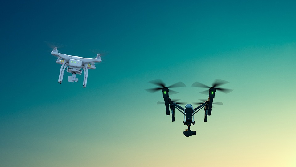
The six-foot drones first appeared sometime in mid-December 2019 over Phillips and Yuma counties, roughly 120 miles (200 kilometers) east of Denver, flying at an altitude of between 200 and 300 feet every night between 7:00 pm and 10:00 pm. The drones fly in square patterns of approximately 25 miles (40.2 kilometers) before moving on to the next area.
“They’ve been doing a grid search, a grid pattern,” Phillips County Sheriff Thomas Elliott says of the squadron, made up of an estimated 17 drones. “They fly one square and then they fly another square.” Elliot reports that one resident tried following one of the drones, but he had to give up the 50-mph (80.5 km/h) chase after running low on gas.
Both the number of drones in the group and the size of each individual craft make it unlikely that the squadron is being operated by hobbyists, given how much money it would cost to procure a fleet of that size. The Air Force, the Drug Enforcement Administration, and the US Army Forces Command all say the drones aren’t being flown by them, meaning that the squadron likely belongs to a commercial organization.
The FAA also has no information on the drones, according to the Denver Post, as drone pilots aren’t required to file flight plans unless they’re flying in controlled airspace, like near an airport.
Aside from the question as to who has been flying the phantom drone fleet around Colorado, there is also the question as to why this is being done. The grid pattern being flown by the drones suggests either a search pattern, as suggested by Sheriff Elliott, or they are being used to map a section of northeast Colorado. Drones used for agricultural surveillance are often flown at night, taking advantage of the cooler landscape to allow their infrared cameras to get clearer images of crops.
But despite all the mystery surrounding the drone fleet, its operator doesn’t appear to be breaking any laws, so local law enforcement only appears to be involved as a matter of curiosity. Phillips County Undersheriff William Myers is also urging residents to refrain from shooting down any of the drones: aside from being a federal offence, the high-energy lithium-polymer batteries used to power drones can burst into flames explosively.
“It becomes a self-generating fire that burns until it burns itself out,” Myers says. “If you shoot a drone down over your house and it lands on your house, you might not have a house in 45 minutes.”
Subscribers, to watch the subscriber version of the video, first log in then click on Dreamland Subscriber-Only Video Podcast link.
Wildfires could be stopped rapidly with this kind of technology. Why isn’t it being used?
Ok. So I ressubscribed … I forgot to renew my subscription … and then forgot my password, etc. Anyways … in regards to the drones over Colorado in Yuma and Phillips County. I live in Kit Carson County south of these counties … on the Eastern Plains of Colorado. The forgotten corridor of Colorado along 385 Highway. The Front Range where Denver and Colorado Springs resides gets all the attention. But the Highway 385, Highway 36, and other other such highways on the Eastern Plains are largely ignored by the Snobs of Denver.
The drones are most likely part of the Colorado State Highway system surveying for widening of the roads for the planned expansion of the highways, specifically, the 385 in the Eastern Plains. There is more large trucking traffic now in this area … NAFTA. The I25 corridor on the Front Range is way too busy now, and the trucks need to travel north to I80 and Canada. The details for expansion of the highways in the Eastern Plains has been on the NAFTA website and State of Colorado highway since mid 2000s.
Plus, they are adding more and more of those wind turbines here also.
And, I would think that the surveying of the area would be most likely at night as data for night time driving is just as important as daytime.
I talked to one of the workers manning a drone on the Hwy 385. My husband and I stopped and talked to him. Hwy 385 has little or no berm on either side as it mostly surrounded either by prairie, fields, or cows grazing.
Well…
“Phillips County Undersheriff William Myers is also urging residents to refrain from shooting down any of the drones: aside from being a federal offence, the high-energy lithium-polymer batteries used to power drones can burst into flames explosively.”
That would be a good way to spread a bio weapon, drop from low elevations at night.
Another interesting article …….
https://www.thedrive.com/the-war-zone/31631/there-is-a-big-and-bizarre-drone-mystery-unfolding-in-rural-colorado